The Vltava River, Lipno Dam
The Vltava River
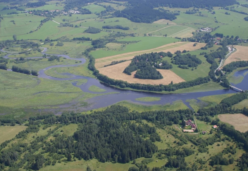
Behind the village of Želnava in the direction to Nová Pec the Vltava River pours into Lipno Dam.
Lipno Dam (35 km)
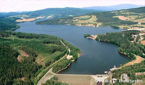
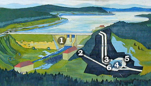
With its area of 4 650 hectares, Lipno Dam, often called the Sea of South Bohemia, is the largest artificially built water-work in the Czech Republic. The valley reservoir, located mainly at the territory of the Šumava Protected Landscape Area, is the highest-elevated stage of the Vltava River's cascade. The artificial lake extends between the villages of Želnava and Lipno nad Vltavou in the length of 48 km. The dam built in 1950-1959 has an average depth of 6,6 m (21 m in maximum) and retains water of the volume of 306 million cubic metres.
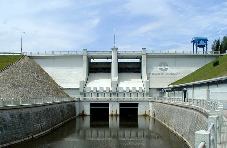
Dam
The dam of the reservoir was built in vicinity of the village of Lipno nad Vltavou, about 20 km to the south-west of Český Krumlov. It is a 296 m long and 25 m high rockfill dam with concrete spillways and two outlets. Water leakage under the mass of the dam is prevented by caissons (huge tanks of steel sheets weighing 60 tons), which were embedded with concrete after being installed into the required depth. The overall weight of one caisson including the concrete is 230 tons. The road on the top of the dam connects Lipno nad Vltavou with Vyšší Brod.
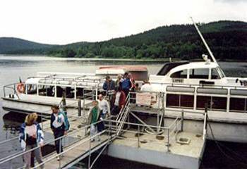
Ship transport
Besides several ferry lines providing transport connection between the inland and formerly inaccessible area along the Czech-Austrian border, there are various sightseeing cruises.
Hydro Power Plant (Lipno I)
Lipno I Hydro Power Plant is located in a 38 m high and artificially constructed cavern in the depth of 160 m. Water is conducted by two ducts with the diameter of 4,5 m through the chamber of spherical valves to two Francis turbines. Each of them is fixed to the generator with the output of 60 MW at the maximum flow rate of 46 m3/s. Spill water is carried away from the turbines through the 3,6 km long underground waterway into the balancing reservoir Lipno II in vicinity of Vyšší Brod.