TOURISM AND SPORT
Bikes, Scooters
Two long-distance cycling routes traverse the village of Hamry. The cycling route No. 33 called the Šumava Arterial Road (Šumavská magistrála) passes directly through the village and connects the Úhlava eco-region with the Šumava-West micro-region and further on with southern part of the Šumava mountains. The other long-distance route No. 2055 traverses the region along the country border formed by the mountainous ridge of královský hvozd and connects Všeruby with Železná Ruda as well as German border zone villages of Eschlkam and Rittsteig with Hamry.
These long-distance routes are connected to local round trip paths.
Circular paths through Královský hvozd
1. distance 24 km
Central Hamry (Důl pod Ostrým) – front-end Hamry (Hamry farmstead) – Grůbr's farmstead (33) – Traverza (2049) – Vöderhof road (Krmelcová) – crossroads nearby Stateček – central Hamry (2102)
2. distance 30 km
Central Hamry (Důl pod Ostrým) – front-end Hamry (Hamry farmstead) – Špirk – Zadní Chalupy (2049) – Lomnice – Pod Lovečnou – Stateček (2055) – crossroads nearby Stateček – Hamry (2102)
3. distance 46 km
Central Hamry (Důl pod Ostrým) – front-end Hamry (Hamry farmstead) – Špirk – dam – Stará Lhota (33) – Pajrek – Zadní Chalupy – Lomnice – Pod Lovečnou – Stateček – Bílá strž – Černé (Black) Lake – Špičák saddle (2055) – Špičák tunnel – rear-end Hamry – central Hamry (33)
Circular paths Prenet – Můstek – Pancíř
1. on the ridge of Prenet – Můstek – Pancíř 33 km
Central Hamry (Důl pod Ostrým) – front-end Hamry (Hamry farmstead) – Zelená Lhota – Zelená Lhota railway station – Křížový vrch (2053) – Prenet – Můstek – Pancíř – Špičák saddle (2100) – Špičák tunnel – rear-end Hamry – central Hamry (33)
2. beneath the ridge Prenet – Můstek – Pancíř 18 km – short
Central Hamry (Důl pod Ostrým) – front-end Hamry (Hamry farmstead) – Zelená Lhota – Zelená Lhota railway station (2053) – Denkův dvůr – Jižní Stráně – Hojsova Stráž (2100) – Hamry railway station – rear-end Hamry – central Hamry
3. beneath the ridge Prenet – Můstek – Pancíř 33 km – long
Central Hamry (Důl pod Ostrým) – front-end Hamry (Hamry farmstead) – Zelená Lhota – Zelená Lhota railway station (2053) – Denkův dvůr – Jižní stráně – Hojsova Stráž – Nad silnicí – Pod Habrem – Špičák saddle (2100) – Špičák tunnel – rear-end Hamry – central Hamry (33)
4. Great ridge round tour 55 km
Central Hamry (Důl pod Ostrým) – front-end Hamry (Hamry farmstead) – Zelená Lhota – Zelená Lhota railway station – Křížový vrch (2053) – Prenet – Můstek – Pancíř – Špičák saddle (2100) – Černé (Black) Lake – Bílá Strž – Stateček – Zadní Chalupy (2055) – Grůbrův dvorec (2049) – Hamerský dvůr – Kollerův dvůr – central Hamry
The paths may be combined, shortened or prolonged according to the physical condition, weather and taste.
Hiking
Ostrý – Velký (1293 m n. m.) and Malý (1266 m n. m.)
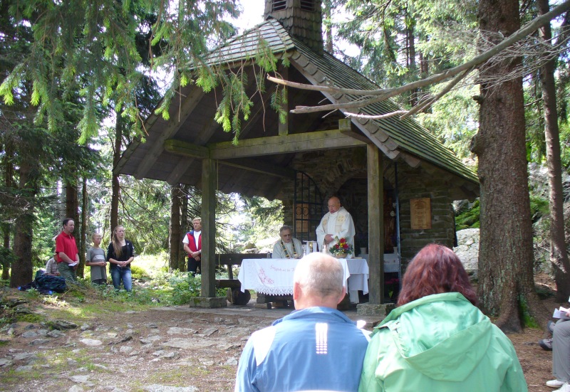
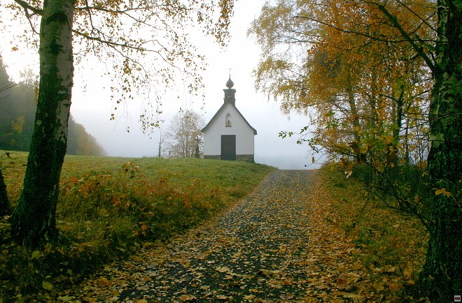
Ostrý is a dominant two-peak mountain of Hrálovský hvozd. The higher peak (Velký Ostrý), with a cross standing on top of it, is traversed by the country border. On the Bavarian side below the peak there is a tourist cottage built in 1897. The lower peak (Malý Ostrý) is on the Bavarian side of the border. Both mountain tops are connected with a saddle, where a small chapel with a belfry is located.
Ostrý is not only the main local tourist destination but also acts as a symbol of the whole cross-border region of Královský hvozd, which is well expressed by the project of the "Stones of Touch".
The mountain is accessible from both sides of the border that are connected by the pedestrian tourist crossing point Ostrý - Kamenná brána. From the Bavarian side set out for the hike from Lohberg or Lambach. From the Czech side the mountain is accessible from Hamry - Koller's farmstead (church) along the green-marked, red-marked and blue-marked tourist paths, from central Hamry - Důl pod Ostrým along the blue-marked path or from Hamry - Hojsova Stráž railway station along the yellow-marked or blue-marked tourist paths.
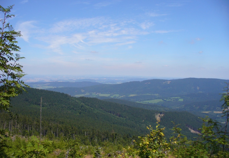
The top of the mountain offers beautiful view of the landscape on both sides of the border, e.g. of Jezerní Mountain, Špičák, Pancíř, Prenet, into the Úhlava valley and further on to the region of Klatovy and Domažlice on the Czech side. On the Bavarian side, one can admire the view of the highest Šumava mountain Javor, Hoher-Boger or Lam valley, Bílá strž, Černé (Black) Lake or Čertovo (Devil's) Lake.
Once you are in Královský hvozd, you must not omit the national natural reserve of Bílá Strž.
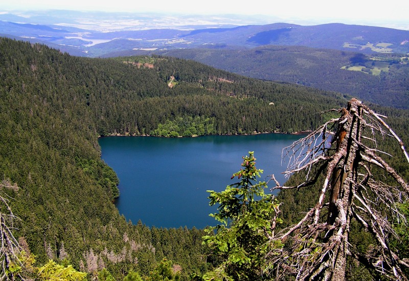
From central Hamry (Důl pod Ostrým) take the blue-marked tourist path along the Bílý stream, from the crossroads nearby Stateček take the yellow-marked tourist path. After four kilometres you will get to the waterfall (150 m bellow the trail). To get to the waterfall you can also start at Hamry – Hojsova Stráž railway station and take the yellow-marked path (5 km) and then the red-marked path towards Černé (Black) Lake (4 km). You will certainly feel breathless once you get view of the largest glacier lake with the 300 m high lake wall.
To return to Hamry, go along the cross-country skiing track and then along the yellow-marked path to the railway station or along the blue-marked path to central Hamry. Another option is to visit also the other glacier lake of the area called Čertovo (Devil's) situated in the distance of 3 km. From here you can go to the railway station of Železná Ruda - Špičák (2 km) or to Špičák saddle (3 km) and back to Hamry along the Hamry road (9 km).
Prenet – Velký (1070 m n. m.) and Malý (1006 m n. m.)
The eastern side of the Úhlava valley, which is formed by the mountainous ridge of Pancíř and Můstek, is terminated by Prenet two-peak mountain and a plateau, where the historical Chapel of St. Kunhuta is standing - former significant pilgrimage place at the estates of Králováci free border guards.From Hamry it is possible to take a round tour to Prenet along the green-marked path: Koller's farmstead (church) - Mužík – Špat's farmstead – Zelená Lhota – Křížový vrch – Prenet, from Prenet acroos Jižní Stráně – Hojsova Stráž crossroads – Hamry railway station – central Hamry (round trip - 15 km in total).
Prenet offers nice view of the Czech upcountry and of Královský hvozd panorama with Ostrý mountain.
Instructive path "Through the Úhlava Alluvial Plain"
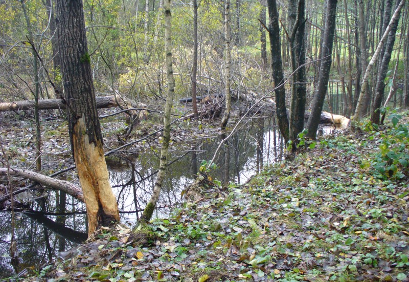
The starting point can be found in Hamry - Koller's farmstead, next to the tourist shelter with the entrance panel and a map. The path has five stations introducing upper reach of the Úhlava to the visitors and informing them about its length, springs, hydrology, spontaneous origins of woods on deserted and formerly cultivated soils, about settlement in the area, about the landscape transformations, etc. Three wooden foot-paths lead across the fenland, where you can see a peasant's household Fuks' farmstead, two water springs V lipách and at the Fuks' farm, a small military fort, as well as the work of the natural builder - the beaver, unique habitats with various protected plants and animals.
The natural reserve was established in here at the territory of 50,21 hectares on 1st December 2003.
Instructive path "Brčálník"
From Zadní (rear-end) Hamry take the green-marked tourist path. After three kilometres you will reach the instructive path "Brčálník" (4,5 km) opened in 2005 and focused on history and nature of the area.
The path goes through the built-up area of Brčálník to the lookout of the ridge of Královský hvozd and Jezerní Mountain with panoramic description of the view. Further on it leads to the railway viaduct, passes it through and continues through the forest past the recreational cottages to the Úhlava and to the border of the nature reserve Brčálník fenland to the lookout of Můstek ridge.
To get back to Hamry, go past the reservoir and the pumped storage hydro plant of the Černé (Black) Lake to the Hamry road. After three kilometres you will get to Zadní Hamry.
Kreuzwinkel pilgrimage place
The pilgrimage place is accessible from central part of Hamry along Tolary road, from the railway station along the yellow-marked tourist path and then Tolary road or the green-marked path.
Former mass chapel beneath Křížový vrch (hill) in the rear-end part of Hamry beyond the fenland of the Křížový stream with the view of the Úhlava river, of the chapel at Knížecí dvůr and of the former Gustavstahl factory.
Extinct village of Zadní Chalupy
In the distance of ten kilometres from central Hamry along the yellow-marked tourist path and subsequently Wöderhof road you will come to Zadní Chalupy. The extinct village is reminded of by the tourist shelter, a preserved well of former school building, several crosses and overgrown building foundations in place where the pub used to be. Anton Schott, the classical author of the Šumava German literature was born right in here. Nearby, there is an observatory from the times of the country border protection, an overgrown signal strap and a military fort. This military area that used to be cultivated has nevertheless turned into the realm of wild nature.
Cross-Country Skiing Hints
We would like to recommend the cross-border project of the ski track beyond Ostrý mountain from the Bavarian ski resort in Rittsteig, across the tourist border crossing of Zadní Chalupy - Helmhof, passing through the Královský hvozd ridge across Lomničky, Lovečná, Stateček, to Černé (Black) lake and from here to Zadní Hamry, which is connected to another track nearby Lovečná. The ski track is accessible from Hamry after 1 600 metres along the blue-marked tourist path. The track is maintained occasionally, for more info see www.langlauf-rittsteig.de.
Up-to-date information about conditions of cross-country skiing tracks
Downhill Skiing
Špičák - Železná Ruda Ski Resort
Nad Nádražím- Železná Ruda Ski Resort
Velký Javor, Germany Ski Resort
Other Information
Bathing
Aquapark (water park) Kdyně, www.bazen-kdyne.cz / tel 371 010 299
Indoor swimming pool Klatovy, pb@tsklatovy.cz / tel 376 313 200
Osserbad Lam (Germany) , www.osserbad.de
Other
Animal park park Lohberg, www.lohberg.de/tierpark