Kunžvart castle ruins
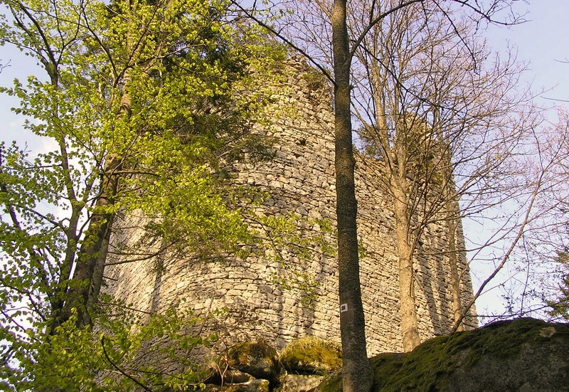
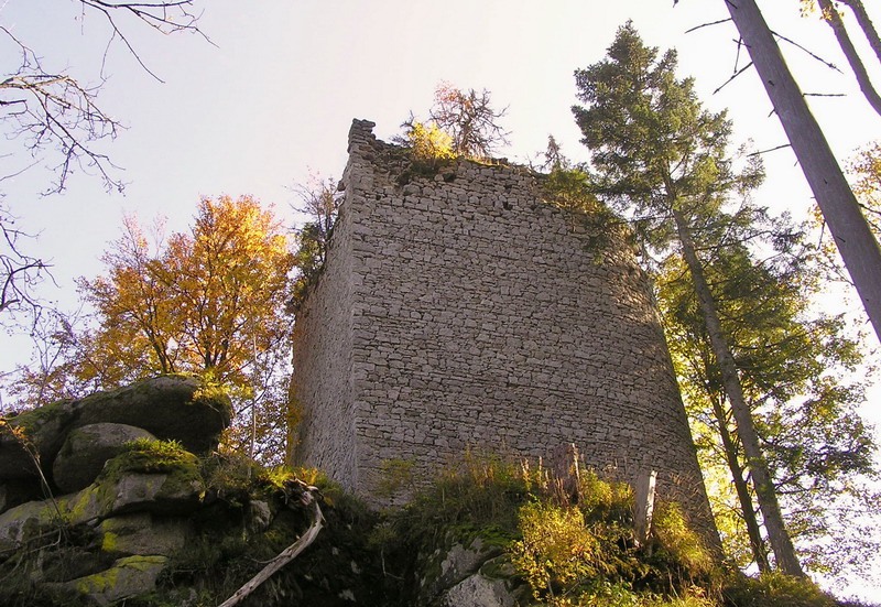
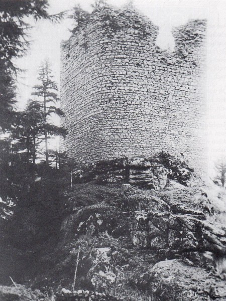
The ruins of the Kunžvart castle (derived from Königswarte - King's Guard) tower on the rocky top of Strážný mountain over the village of the same name at the Czech-German border at the altitude of 115 metres some 2 km to the north-west of the village. It was practically impregnable stronghold due to its great location enclosed on three sides by rock walls below and by a deep moat.
The castle served to the protection of the ancient trade route branch from Vimperk to Passau. The oldest written record of the castle dates from 1359, when the King Charles IV signed it over as property of Pešek of Janovice and the sons of his brother Herbert together with the Vimperk estates. For all the following Vimperk owners after the family of Janovský (Kaplíř family of Sulevice from 1395, Malovec family of Malovice from 1494, Jáchym of Hradec from 1553, Rožumberk family 1554-1601, Kolovrat family of Nové Hrady 1601-1630, Eggenberk family 1630-1719, and finally Schwarzenberg family) it was much more comfortable to reside at the château of Vimperk. The castle was completely abandoned in 1547 and turned into ruins after the fire of 1578.
The heart of the guarding castle is formed by a squared tower built of the accurate lined masonry on the granite rocky elevation reliably protecting it from three sides with rock walls. The original jamb from the tower's ground floor of carved granite blocks with a bevelled edge and a semicircular arching was later used as a portal of the farmstead No. 5 in the village of Kořenný nearby. The findings of thin-walled and graphite ceramics deposited at the subsidiary of the Institute of Archaeology of the Academy of Sciences of the CR in Pilsen may be classified into the period of the early 14th century. Only the 15 metres high residential tower (originally three-storeyed) has been preserved up till the present day.
The ruins of the Kunžvart castle are accessible by yellow-marked tourist path from Strážný (approx. 3,5 km) or by blue- and yellow-marked paths from Horní Vltavice (approx. 9 km).