Golden Path
Golden Path (Goldener Steig) is a general name of the system of the medieval trade routes going in north-south direction that were crossing the Šumava forests and connected Bohemia with the Danube region. The designation "Golden Path" originates from the early 16th century as an expression of the extraordinary yield of the trade carried out by there.
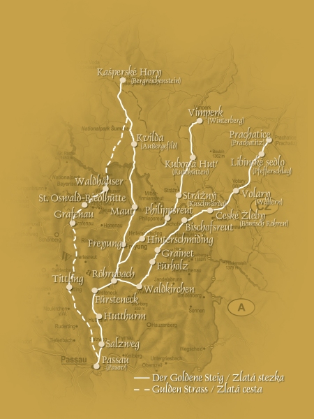
Kašperské Hory branch of Golden Path
The first written record of the Kašperské Hory branch of Golden Path to Passau and Bavaria dates back to the same year as the construction of Kašperk castle was initiated - 1356. Heinczlinus Bader received in the same year the lands nearby the settlement of Červená pod Malou Losenicí into the hereditary free usage from the Emperor Charles IV for his faithful services in searching and demarcating of the trajectory of this new road. The mining town of Kašperské Hory (Reichenstein) and its surroundings was an important centre of gold mining of the period.
The Golden Path (Goldene Straße) branch Kašperské Hory – Kozí Hřbety – Horská Kvilda – Filipova Huť – Waldhäuser – St. Oswald – Grafenau – Passau was built as a section of the intended long-distance trade route from Bohemia past Salzburg to Venice. It was 2,5 m wide, paved and enabled transport by merchants' wagons.
The path led from Kašperské Hory to the Losenice river valley and from here ascended to Kozí Hřbety and continued to the watchtower in Zhůří, to go on past Zhůřská peat-bog to Horská Kvilda and further on to Filipova Huť. From here the route headed to the south into the places were so-called Vogelstain (today Ptačí) reservoir was built in the 19th century, from where a steep uphill rise continued by the slopes of the mountains Malá and Velká Mokrůvka towards Luzný that it circumvented by its eastern slope. Further on there was a descent into the village of Waldhauser, the first settled location on the German side.
The mostly hilly concept of the path was later abandoned and the new trade route past Březník and along the Luzenský stream to the south-west slope of Luzný mountain where it crossed the border in the place historically known as the Blue Column (Modrý sloup - Blauen Saulen) was completed in 1572.
Since the late 16th century, Bavarian dukes used the Šumava Golden Path branch for the transport of salt to Bohemia, thus competing Passau and Golden Path. This competition ended up in 1608 by the contract of 1608, according to which Bavaria was to sell salt to Passau from where it was transported along the Golden Path to Bohemia. That caused serious decrease in importance of the Golden Path Šumava branch. The Thirty Years' War (1618-1648) and the years after brought final extinction of the ancient trade roads in spite of several attempts for recovery.The real vehicle of trade on the Golden Path were the pack animals (Säumer) and farmers who were transporting the goods for consideration, either on their own cost or in service of the wholesalers.
Importance of the Šumava paths
The old paths across Šumava were not important only as a means of trade and travelling. They also had an irreplaceable role in the area of conveyance of ideas and cultural values exchange. It is pleasing that the historical reminder of the ancient Šumava paths has been revived by the endeavour to find the ways for recovery of friendly neighbourly contacts of people at both sides of the Šumava frontier.
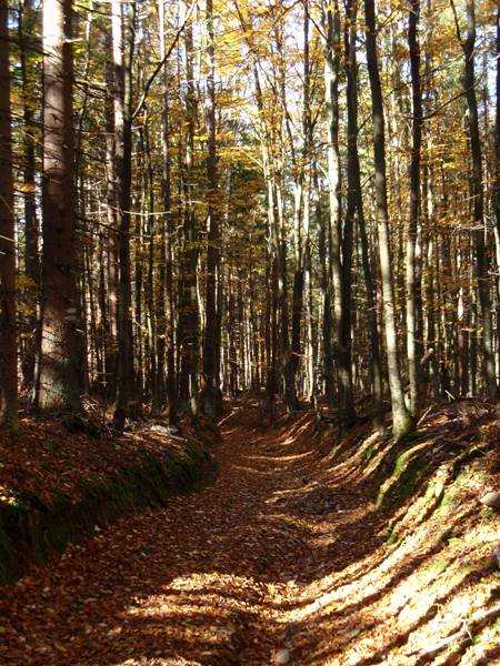
The Golden Path is well perceivable between Filipova Huť and Horská Kvilda, as well as in the surroundings of Luzný mountain.